Kayak and Canoe
Paddle Allen County
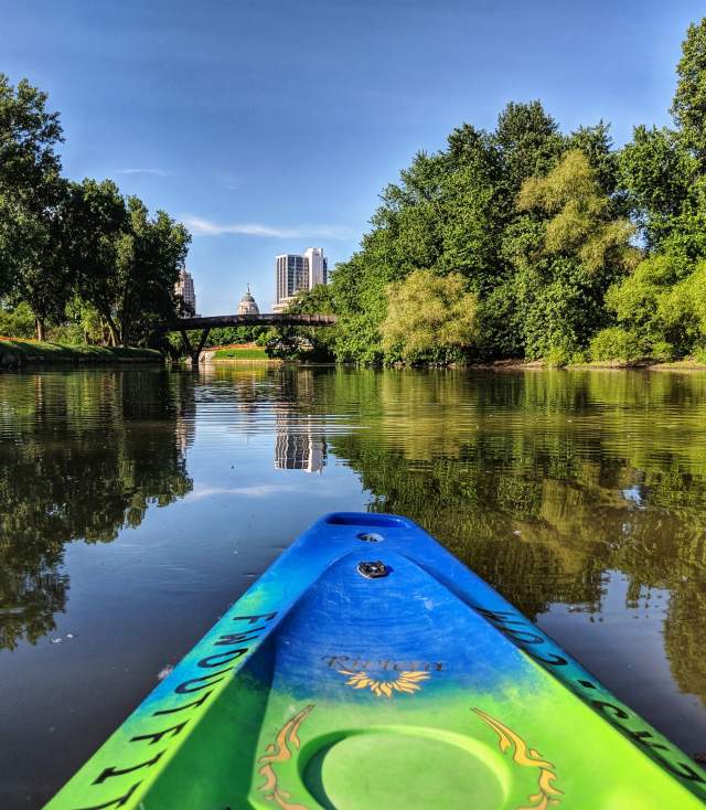
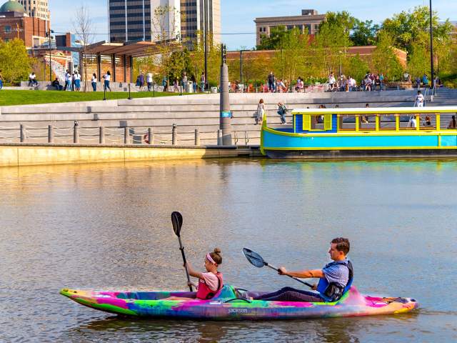
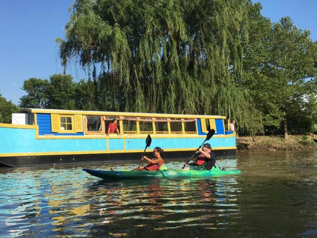
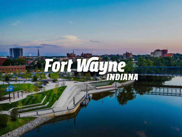
Fort Wayne was built at the confluence of three rivers: the St. Joseph River, St. Marys River, and Maumee River. Visitors can enjoy the diverse offerings of these rivers as they paddle through urban, residential, forested and agricultural lands, each providing a unique perspective on life in northeast Indiana. So, put in and paddle any of the following recommended water trails.
If you didn’t bring your canoe or kayak with you, you can rent one at Fort Wayne Outfitters and Bike Depot, located at 1004 Cass Street on the banks of the St. Marys River. You can use your own equipment and they can transport you, or you can rent your watercraft right from them.
Watercraft can also be rented from Earth Adventures Unlimited located at 1804 West Main Street, 46808. They will help renters strap the boat on their car, to put in wherever you choose.
Local outfitters can help you choose the best route for your group, or below are just a few of our favorite paddles that you may enjoy. In addition, you can access our digital HIKES, BIKES and PADDLES pass to earn free prizes as you explore our rivers!
Curly's Suspension Bridge
Geared toward paddlers with a little more experience
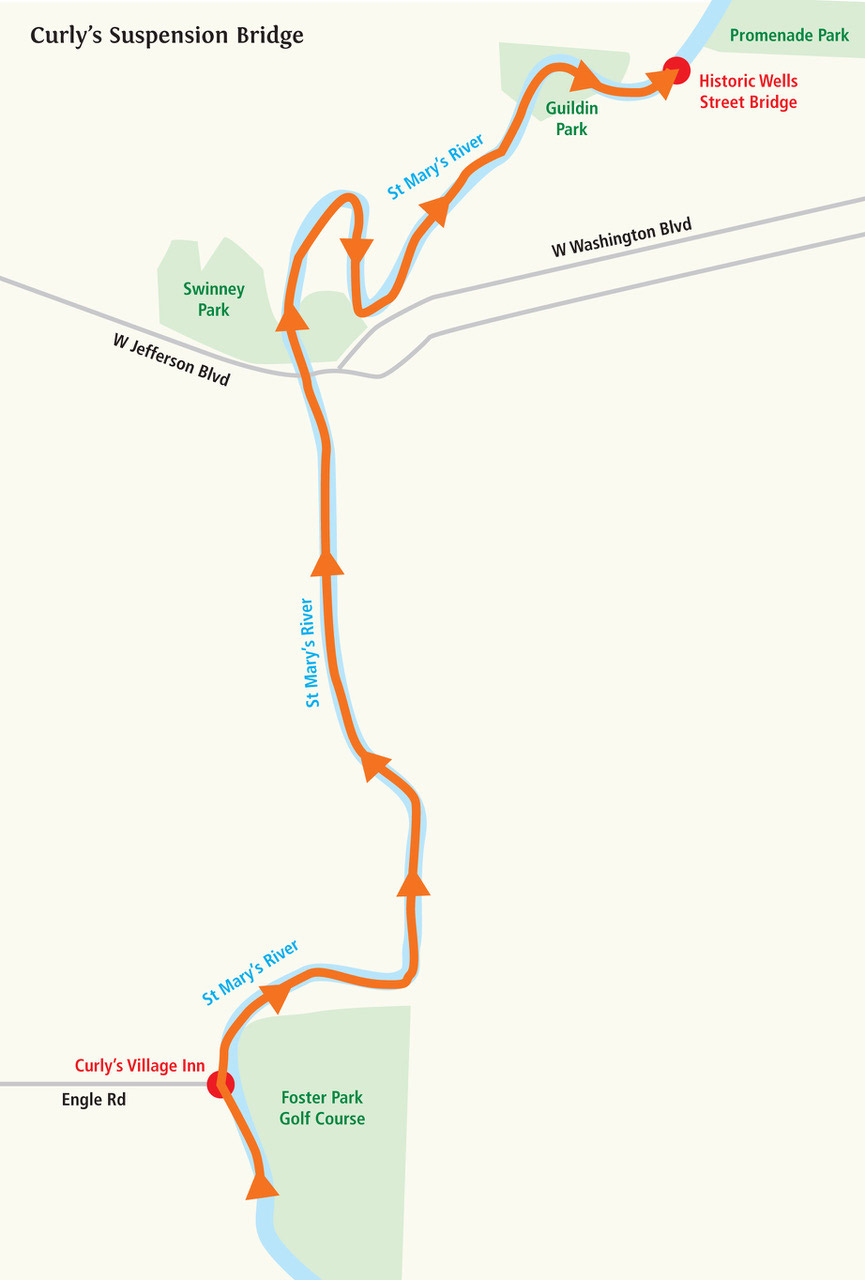
Start at Foster Park and paddle down the St. Marys River to Promenade Park. Along the approximately 4 mile paddle you will get to see beautiful Foster Park and Suspension Bridge; Curly’s Village Inn, a Fort Wayne staple for over 40 years; Swinney Park and Suspension Bridge; an amazing view of Fort Wayne’s skyline; Guldin Park; and the Historic Wells Street Walking Bridge. This paddle will take you approximately 2 – 2.5 hours. View Trail Map
Johnny’s Rope Swing Adventure
Perfect for beginner paddlers
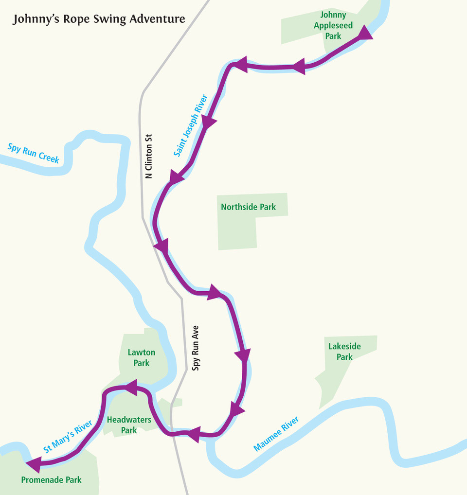
Start at the Boat Ramp off of Harry Baals Drive at Johnny Appleseed Park and float downstream past Stevie’s Island, a local favorite hangout for paddlers, to the confluence where our three rivers meet. You will then take a right (westerly) and paddle upstream on the St. Mary’s River to the Promenade Park boat pier. The total trip is approximately 3.7 miles. Along the way you will pass by Don Hall’s The Deck, a local eatery that also has a pier if you want to stop for a bite to eat on the banks of the St. Mary’s River; the Historic Old Fort which is a replica of the original Fort Wayne built under command of Major John Whistler in 1816; Headwaters Park; and the Dr. Martin Luther King Bridge. This paddle will take you approximately 1.5 – 2 hours. View Trail Map
Shoaff Park Paddle
A Beginner's paddle through Fort Wayne parks
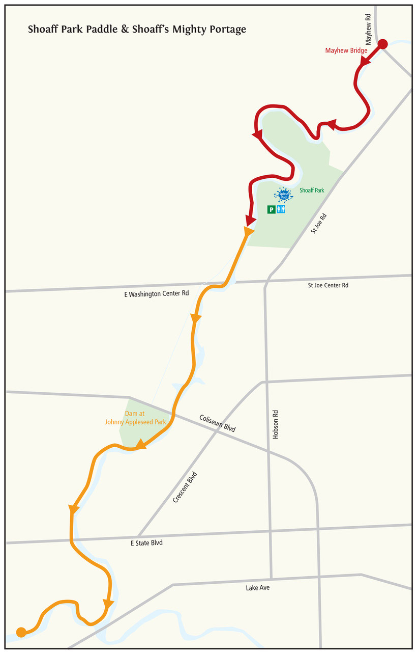
In 2018, Northeast Indiana Water Trails facilitated the installation of a new boat ramp at the Mayhew Road bridge on the St. Joseph River. It is a lovely paddle to put in at Mayhew Rd Bridge and paddle approximately 4 river miles downstream to Shoaff Park. This 4 mile paddle will take you 1.5 hours to complete and will take you through forested river banks with the occasional glimpse of a house or golf course to remind you that you are in a city along this peaceful stretch of water trail. View Trail Map
Shoaff's Mighty Portage
An advanced version of the paddle above, available through Fort Wayne Outfitters
This paddle starts at Shoaff Park and ends downtown at Fort Wayne Outfitters, located in Promenade Park. As the name implies, there is a portage around the dam at Johnny Appleseed Park, but it is a pretty easy portage to make with cement steps for access. (Low Head dams like these are very dangerous and a paddler should NEVER attempt to paddle over the dam. Use the concrete steps upstream of the dam on river right to portage approximately 550 feet to the concrete steps below the dam.)
The paddle is approximately 6 river miles and will take the average paddler 2.5 – 3 hours. View Trail Map
Maumee River
A Wider River to Enjoy
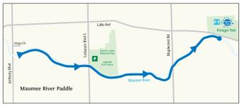
Paddlers can put in at the Anthony Blvd Bridge access site located off of Niagara Dr. downstream of the Hosey Dam. The gravel ramp is steep but a great put-in to paddle nearly 4 river miles downstream to Kreager Park on North River Road. This paddle will take between 1.5 – 2 hours. View Trail Map
Downtown Exploration
An Urban Paddle Trail
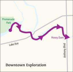
Paddlers can start at downtown’s Promenade Park on the St. Marys River and paddle past Don Hall’s The Deck (or stop for a drink and quick bite to eat before continuing on your journey - The Deck offers a pier to access the shore), past the Historic Old Fort, past the confluence of the St. Joseph and St. Marys and onto the Maumee River. This paddle would take the average paddler about 1 hour. View Trail Map
Historic Covered Bridge
For those looking for a longer paddle
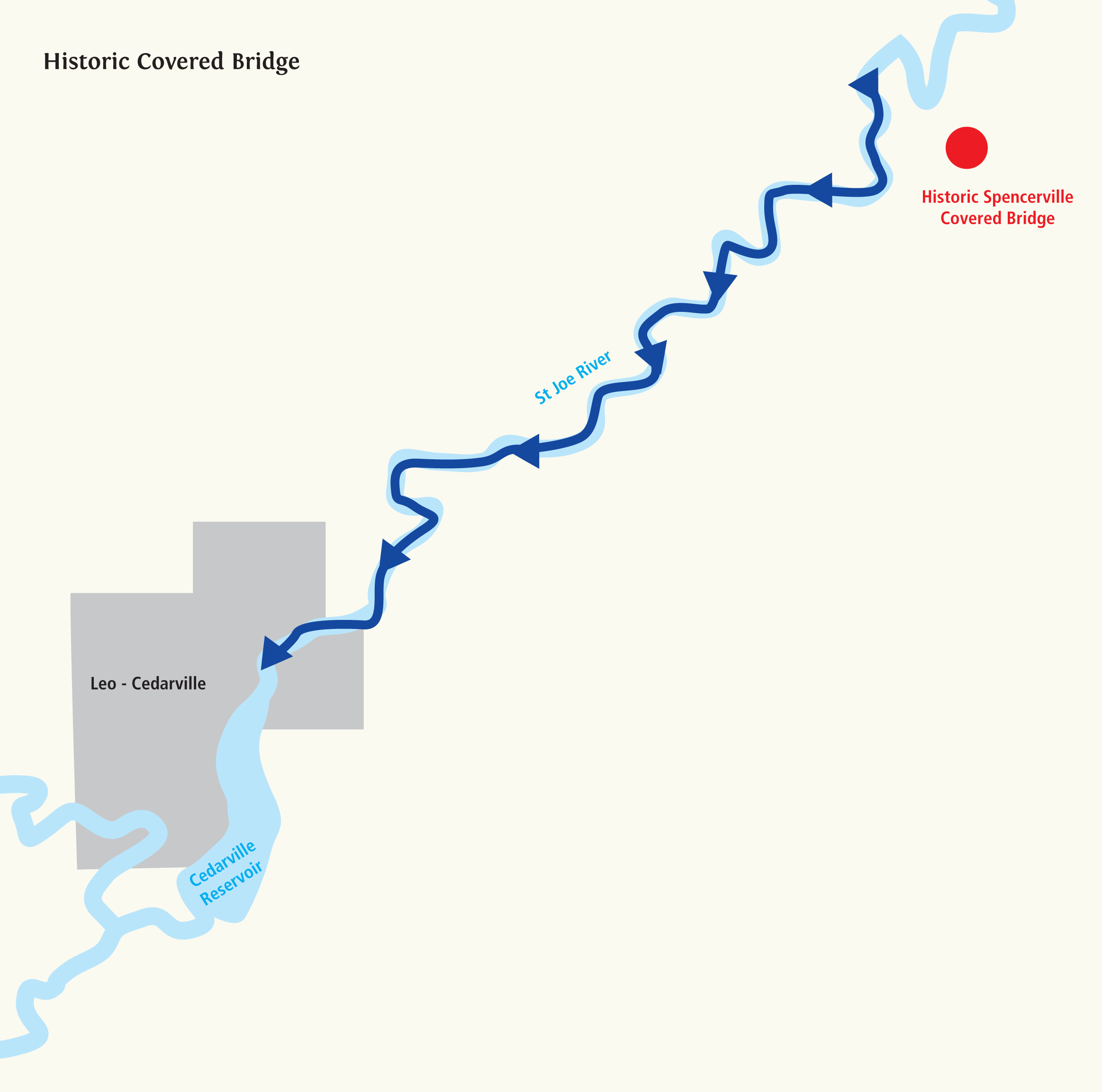
Begin your paddle of the St. Joseph River at the IN Dept. of Natural Resources boat ramp on County Road 68 and paddle approximately 9.3 miles to the DNR access site in Leo-Cedarville. Along the way you will pass the Historic Spencerville covered bridge, and pass through mostly rural farmland and forested land. Expect to see turtles, blue heron, cranes, and smaller mammals along the river banks. The paddle will take you approximately 5-6 hours to complete. View Trail Map
Leo-Cedarville Reservoir
Perfect for the novice paddler or someone looking for a peaceful paddle
The St. Joseph River has a slow flow which makes it possible to put in and take out from the same location for those that have not arranged for a car shuttle. The IN DNR access site on the Leo-Cedarville Reservoir on Grabill Road just east of S.R. 1 is a great paddle for the beginner, or anyone looking for a peaceful paddle. You will see turtles, birds, and other wildlife during you quite paddle. You can also visit the amazing Riverside Park directly across S.R. 1 from the boat access. View Trail Map
Designated Scenic River Paddle
For the Intermediate Paddler
Cedar Creek, a state designated Scenic River, is a spectacular paddle. The paddle begins where the Cedar Creek meets Tonkel Road and ends at the DNR access site on State Road 1, just west of Clay Street in Leo-Cedarville. You will paddle through mostly forested areas and through the protected Metea County Park where wildlife abounds. Due to the nature of the Cedar Creek there are often fallen trees and some small long jams you will that will need to be portaged around between the beginning of the paddle and the next access site approximately 2.8 miles upstream. This route is best to paddle in the spring when the water levels are higher. View Trail Map
Northeast Indiana Water Trails: Bringing the Rivers into Your Life
The Northeast Indiana Water Trails has also developed a waterproof water trail map showing the location of the 29 access sites located on the Cedar Creek and the St. Joseph, St. Marys, and Maumee Rivers, as well as potential dangers on the water trails such as low head dams.
Discover this information, as well as an event calendar, fishing and wildlife info, and a map of all 88 access sites in NE Indiana (18 of which are located in Allen County) at www.neiwatertrails.com
You can also pick up your map up Visit Fort Wayne, Earth Adventures Unlimited, or Fort Wayne Outfitters and Bike Depot. See you on the water!!
